How Do Geothermal Systems Form?
Learn how geothermal systems like the Hengill System formed over thousands of years

A geothermal system is an area with more heat in the subsurface than in other areas. These systems can be found in many places on Earth with varying temperatures. Different types of geothermal systems can be identified based on how heat is transferred within the system, including by convection and conduction.
In regions with tectonic activity and active volcanism, the upward circulation of geothermal fluids transports heat into shallow reservoirs – or even to the surface. These types of geothermal systems are based on convection, influenced by magma chambers and faults. Here in Iceland, geothermal systems are largely convection and fluid dominated – water is readily available in the subsurface, and is then heated up by the relevant heat source.
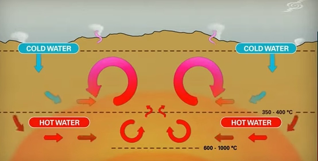
Convection-driven geothermal system
Alternatively, when heat flow is near-normal, conduction is the primary way of heat transfer. These conditions can be found in large sedimentary basins, like intracratonic or foreland basins, or above intrusive rocks producing heat through radioactive decay, like older granitoid intrusions. In these instances, you are less likely to find water in these systems. Often, fluids must be initially injected into the ground where they are heated up before being extracted again. These types of geothermal systems are called Enhanced or Engineered Geothermal Systems (EGS).
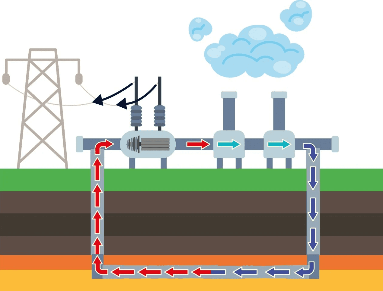
Closed-loop EGS
The Hellisheiði Geothermal Power Plant is situated in the Hengill Volcanic System. Its geothermal system is aptly named and magmatic intrusions in the area lead to heat convection in a two-phase reservoir, where both steam and water co-exist. Those intrusions form during volcanic eruptions in the fissure swarms of the volcano. Lava flows additionally emplaced during the eruptions degas over time resulting in permeable bedrock which allows for easy percolation and circulation of water, which is primarily from different forms of precipitation, like rain or snow. An exception to this would be the geothermal systems of Reykjanes and Svartsengi, which are characterized by inflow of sea water.
By penetrating a permeable boundary along the intrusive body, the water will heat up and start convection. This eventually leads to formation of hydrothermal clay minerals, including various amphiboles, epidote, chlorite, smectite, and zeolites, which are distributed in zones surrounding the reservoir. Altogether, this is also called the cap rock layer, which is an integral part to defining the reservoir in space since clay layers are impermeable for fluids. Their formation can take up to several thousand years. In fact, the intrusions heating up the reservoirs in Hengill are 2000 years and older!
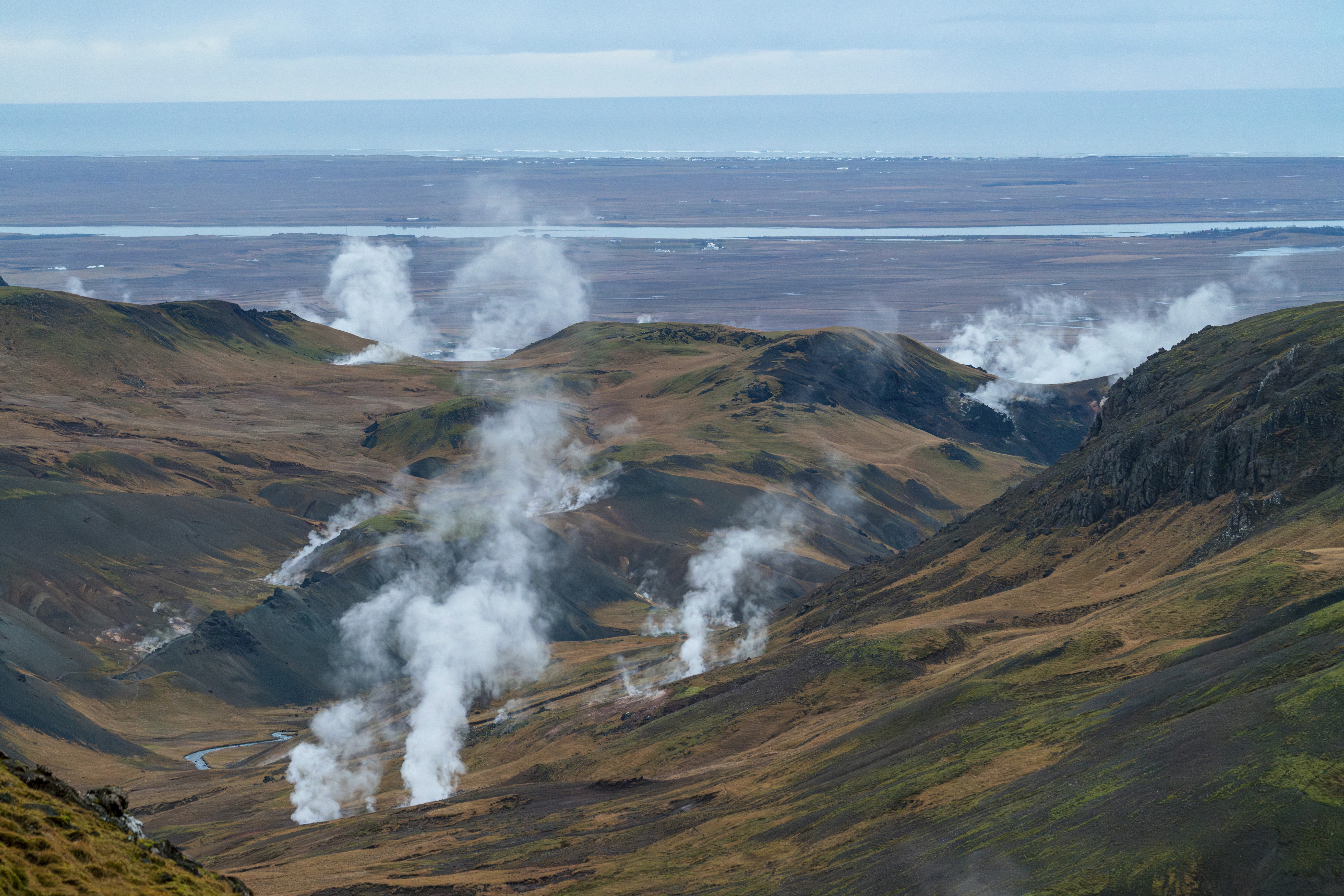
Fluid can travel through to the surface through fault planes and fractures to form geothermal surface manifestations like hot springs, mud pots, and even geysers. Surface manifestations of the Hengill Geothermal System can be found around the Geothermal Exhibition on the hiking trails maintained by Reykjavík Energy and ON Power. They can also be seen in the nearby Hveradalir geothermal area, and in the town of Hveragerði on the other side of the mountains.